
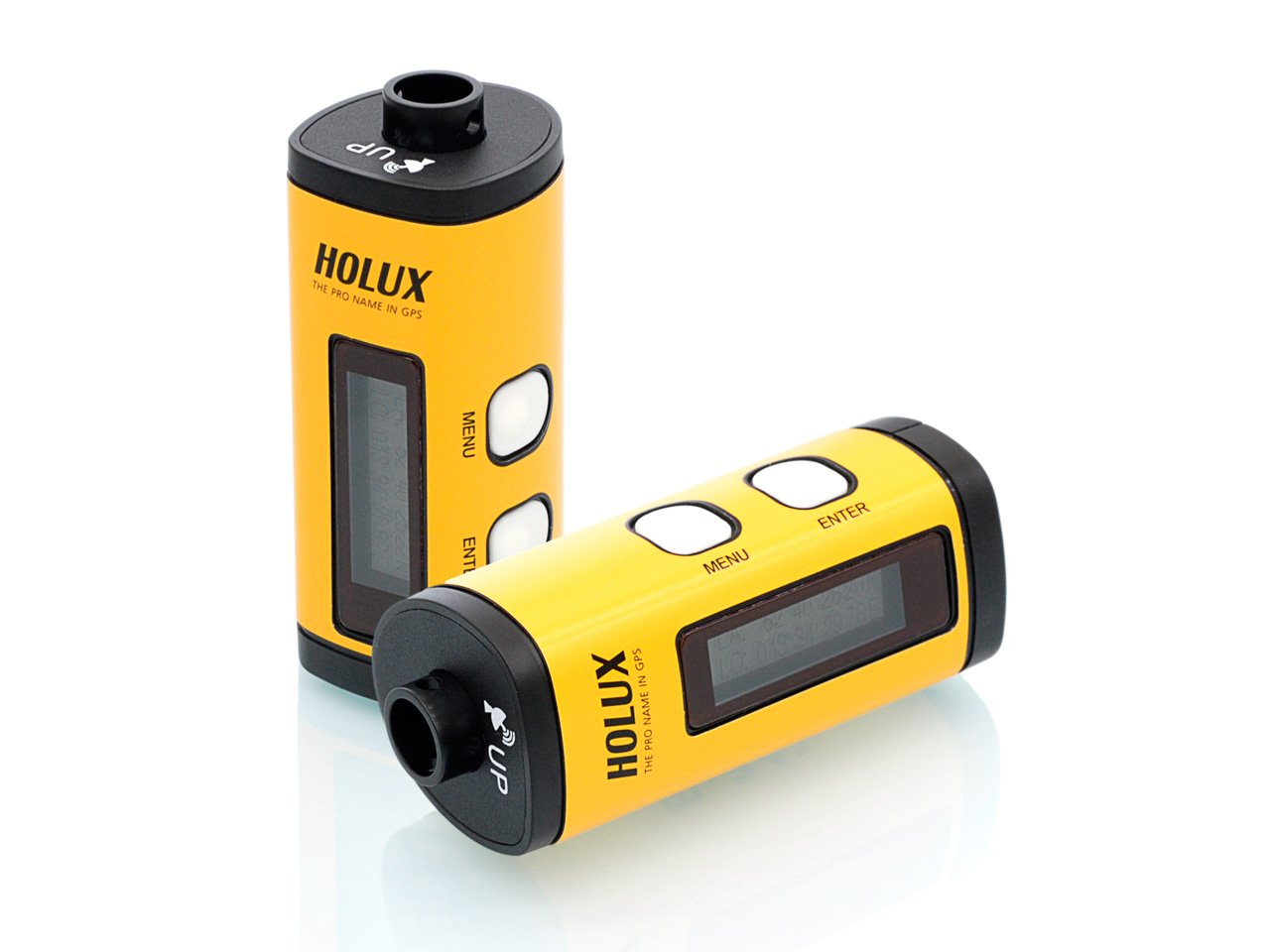
Holux M-241 – Outdoor GPS Datalogger
The Holux M-241 GPS Logger enables real-time recording of coordinates and provides an easy-to-use travel logging service.
The M-241 can record up to 104,724 positions (as of firmware 1.12) with longitude, latitude, time and altitude.
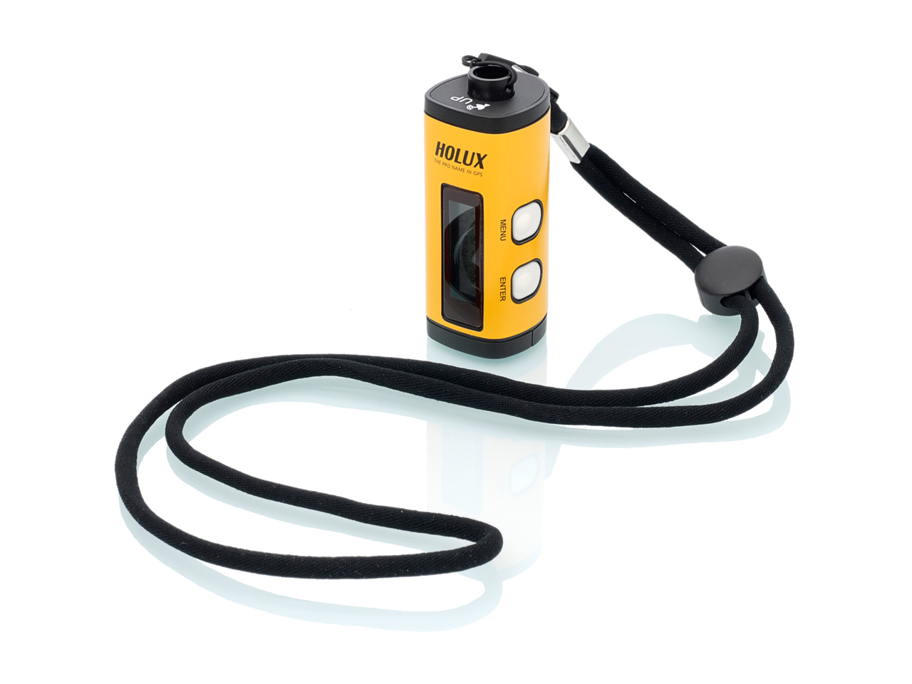
The M-241 is a Holux Bluetooth GPS receiver with datalogger and LCD display. The design of the M-241 is based on the GPS solution from Media Tek Inc. (MTK GPS – MT3318) low-power chip architecture.
Geo-Tagging
The log file can be transferred to the PC for analysis via a USB connection. Due to the standard format used, the log files can also be used by many online services, such as Google Maps, Google Earth, which are interpreted correctly.
You can also combine the recorded positions with the photos taken by your digital camera to provide a geographically accurate price history (GeoTagging). Thus, walking routes or itineraries can be tracked and documented.
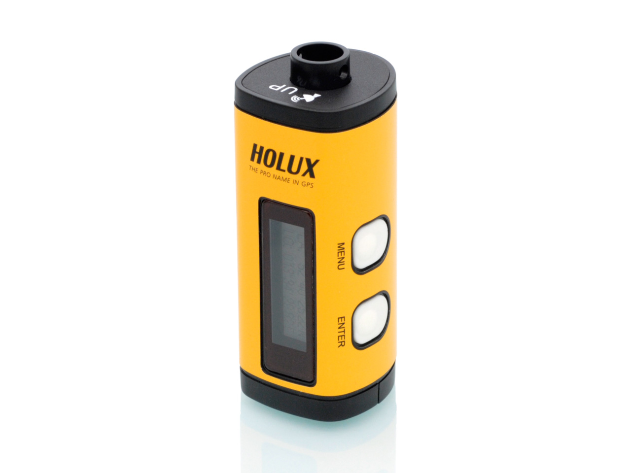
Display, Bluetooth, NMEA
On the LCD screen of the logger, the position information, movement speed, the free space for the recording and the date/time can be controlled directly at any time. The M-241 supports the distance and time recording modes, the kilometers and miles units.
Since the M-241 has a Bluetooth interface, even wireless connections can be realized without any problems.
File formats provided by the program (*.kml -Google Earth, Binary, GPX and *.txt NMEA file format).
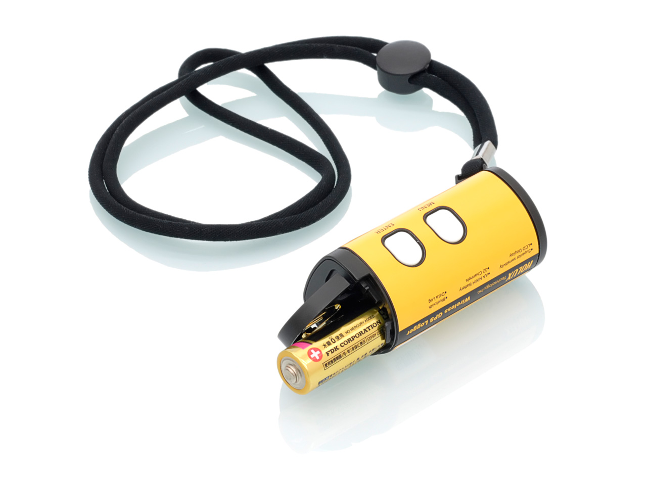
Battery lifetime
The M-241 does not have a battery charging function. Powered by a Mignon (AA) battery, it can record satellite information for up to 12 hours. Various recording modes can be preset with the supplied program.
GPS
Using advanced technology, the M-241 can simultaneously track signals from up to 32 satellites. It records satellite signals every 0.1 microseconds and updates the position data every second.

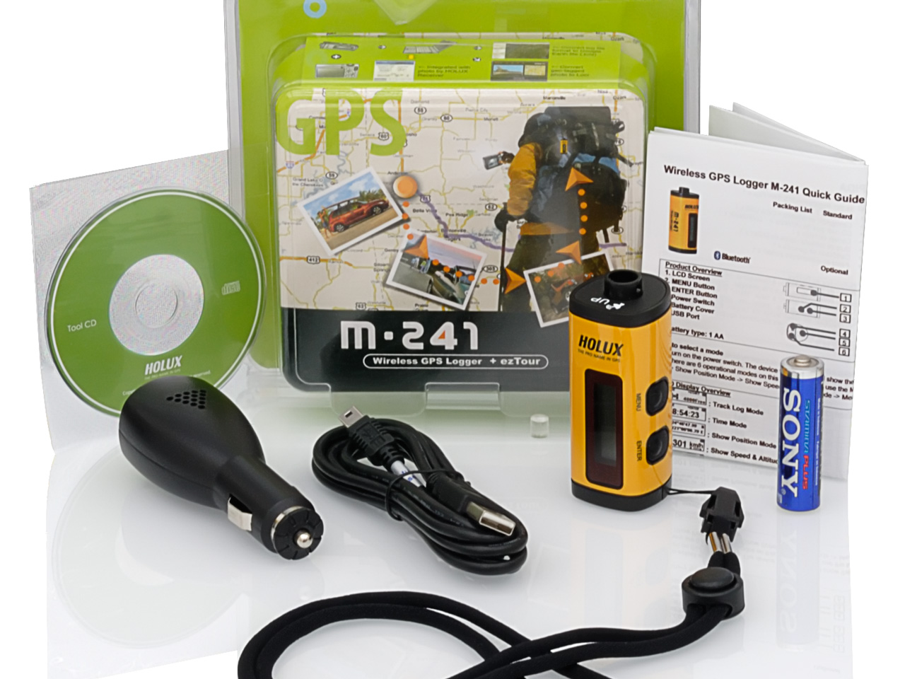
Delivery package
- Holux M-241
- Mignon battery
- Car power adapter 12V
- USB-Datacable
- Program and driver CD
- Short instruction in english language (printed)
- Software ezTour
(License for three installations)
Technical specifications
Modell
| Manufacturer | Holux |
| Model | M-241c |
| Product name | M-241c |
| Product number (P/N) | |
| GTIN / EAN | 4711140530284 |
| UPC | |
| Market availability | 2010 |
Physical data
| Weight | 39 gr (without batteries) |
| Size | 32.1mm X 30mm X 74.5mm |
| Operating temperature | -0°C to +50°C |
| Air humidity | 5% bis 90% (without condensation) |
Interface
| Bluetooth | – |
| Bluetooth range | – |
| Frequency | – |
| Modulation | – |
| Channels | – |
| Signal sensitivity | – |
| Signal output | – |
| USB | Version 1.1 |
| Connector | mini-USB |
| Transfer data | yes |
| Transfer power | no |
Memory
| Built-in memory | up to 130.000 GPS-datapoints |
| External memory | – |
| Export format | KMZ |
Display
| LCD-display | status, time, position, speed, distance, setup |
Power supply
| AA battery | 8 to 12h continuous operation with Bluetooth = off |
| AA battery | 4 to 6h continuous operation with Bluetooth = on |
| AA accu | up to 6h continuous operation with Bluetooth = off |
| AA accu | up to 3h continuous operation with Bluetooth = on |
| Accu charging function | – |
| external power supply | mini-USB, 5V |
GPS chipset
| CPU | MTK 3318 |
| Channel | 32 |
| Receiver | L1, 1575.42 MHz |
| Signal refresh rate | 10 Hz |
| Position refresh rate | 1 Hz |
| Position refresh rate opt. | 5 Hz (without logging) |
| Hot start | ca. 1 Sec. |
| Warm start | ca. 33 Sec. |
| Cold start | ca. 36 Sec. |
GPS Antenna
| built-in antenna | Patch antenna |
| Sensitivity tracking signal | -159 dBm |
| Sensitivity tracking position | -156 dBm |
| Connector ext. antenna | – |
GPS protocol
| NMEA protocol | NMEA0183 v3.1 |
| NMEA format | $GPGGA, GSA, GSV, RMC, VTG |
| Format optional | |
| Height calculation | WGS84 |
| Baud rate | 38400 bits/sec |
| Data/Check/Stop -Bit | 8/N/1 |
GPS position accuracy
| Normal | ca. 3m (without SA) |
| Normal speed | ca. 0,1m/sec (without SA) |
| DGPS SBAS (EGNOS,WAAS) | – |
| DGPS SBAS speed | – |
| DGPS GBAS | – |
| DGPS GBAS speed | – |
GPS dynamic
| Dyn. height | max. 18km |
| Dyn. speed | 515m/sec |
| Acceleration | ± 4 G max. |
| Jerk | max 20 m/sec. |
Leave A Comment